Geospatial Processing, Delivered as a Service
Precog Geospatial provides scalable software and infrastructure solutions designed to simplify the production, processing, quality control, management, and delivery of geospatial data.
Explore SaaS Capabilities Learn About GOATSGeospatial Processing, Delivered as a Service
Precog Geospatial provides scalable software and infrastructure solutions designed to simplify the production, processing, quality control, management, and delivery of geospatial data. Our approach combines purpose-built geospatial software, automated production workflows, and scalable computing infrastructure to help organizations process large imagery and elevation datasets without the cost and complexity of maintaining specialized production environments.
Our solutions are designed around two complementary service models: Software-as-a-Service (SaaS) for automated geospatial workflows and Infrastructure-as-a-Service (IaaS) for organizations that require dedicated or scalable compute, storage, and geospatial processing resources.
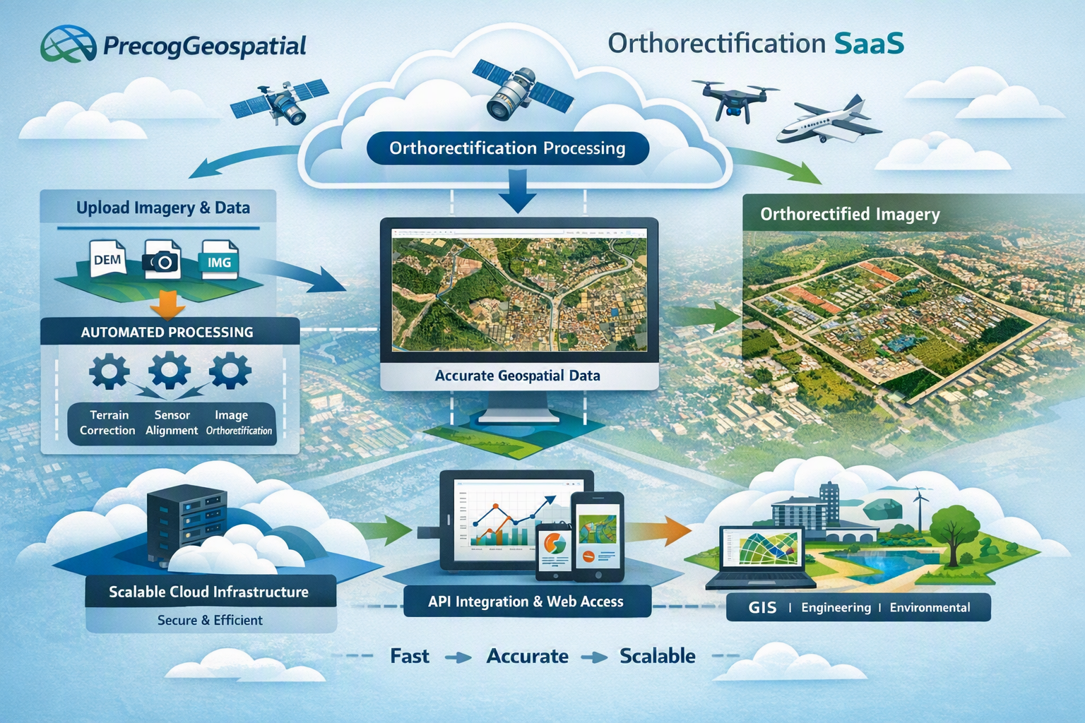
Software-as-a-Service (SaaS)
Precog Geospatial's SaaS capabilities are designed to automate complex geospatial production workflows, including aerial imagery processing, orthorectification, quality control, data management, and delivery.
For orthorectification workflows, imagery and associated project information can be processed through repeatable production pipelines designed to generate accurate, map-ready geospatial products. Automation reduces repetitive manual processing while supporting consistent production methods and quality-control processes across large datasets.
The objective is straightforward: make high-quality geospatial products easier to produce, easier to validate, and easier to scale.
GOATS is Precog Geospatial's geospatial workflow technology for automating and managing orthorectification and related imagery-production processes.
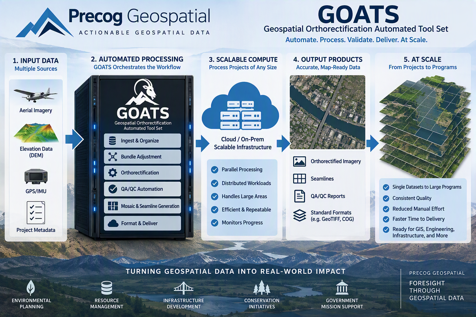
Rather than treating orthorectification as a collection of disconnected processing steps, GOATS was developed around an integrated workflow approach that brings processing, automation, quality control, and data management together within a scalable environment.
Precog Geospatial applies automation and targeted artificial intelligence where those technologies can provide measurable operational value, while maintaining established geospatial and photogrammetric processes as the foundation of production.
GOATS Is Designed Around Four Principles
Automation
Reduce repetitive manual processing and improve workflow consistency.
Scalability
Support projects ranging from individual datasets to large-area imagery programs.
Quality
Integrate QA/QC into the production workflow rather than treating quality as a final step.
Repeatability
Create documented and reproducible workflows that can be consistently applied across projects.
Infrastructure-as-a-Service (IaaS)
Not every organization needs another software application. Some need access to the computing, storage, and processing environment required to work efficiently with very large geospatial datasets.
Precog Geospatial's IaaS approach is intended to provide scalable infrastructure supporting imagery, LiDAR, elevation data, and other data-intensive geospatial workloads. This model can reduce dependence on dedicated customer-owned processing hardware while providing an environment suited to computationally intensive geospatial production.
SaaS and IaaS capabilities can also work together, allowing software-driven workflows such as GOATS to operate against scalable processing and storage resources as project requirements change.
Scalable processing resources
Large geospatial datasets
Imagery, LiDAR, and elevation data
SaaS and IaaS working together
From Raw Data to Decision-Ready Geospatial Products
Precog Geospatial is focused on the complete geospatial production lifecycle, not simply individual processing operations.
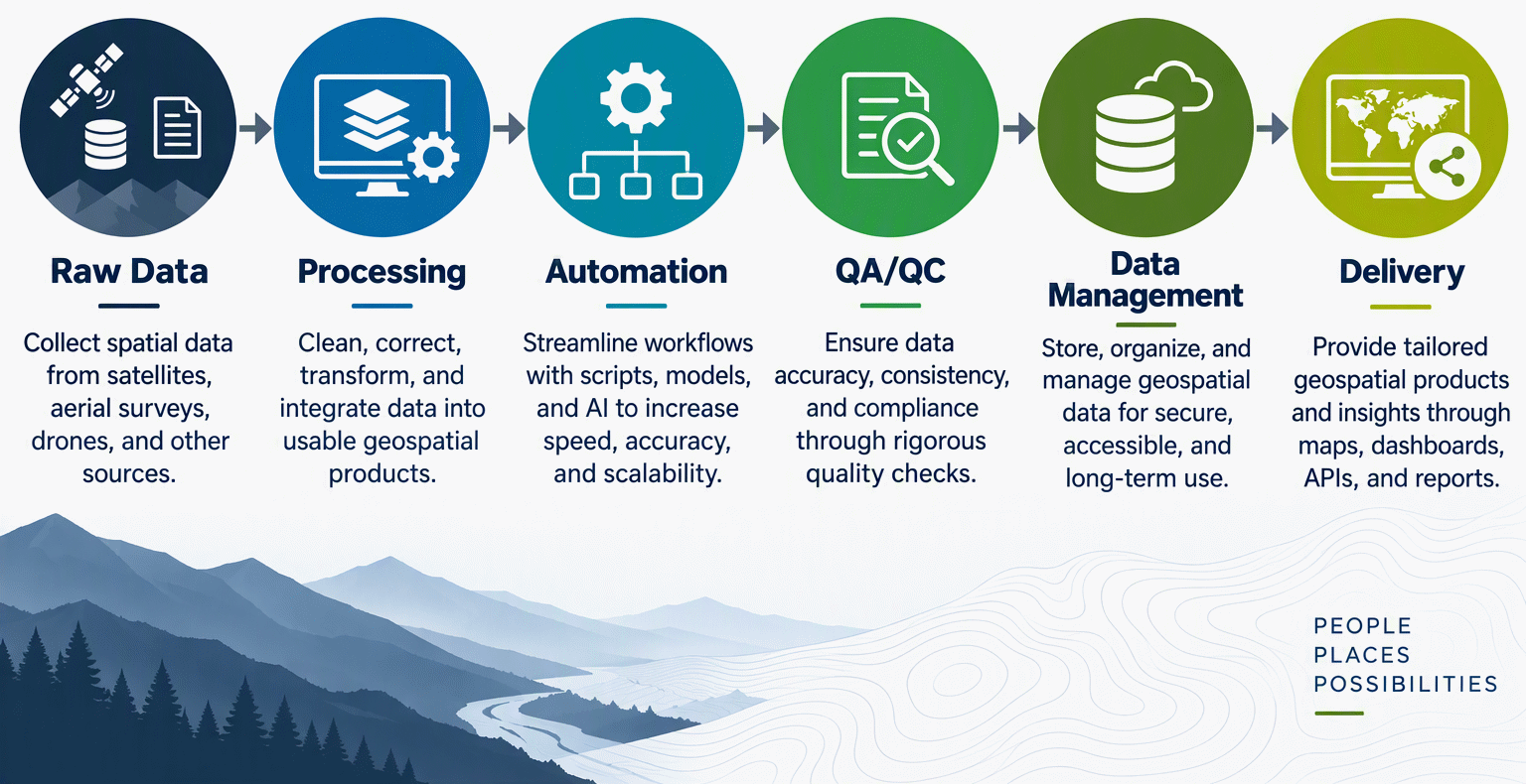
This approach is designed to help customers transform large and complex geospatial datasets into accurate, consistent, and usable products for mapping, GIS, engineering, infrastructure, natural-resource, and other geospatial applications.
Built for Evolving Geospatial Requirements
Precog Geospatial's technology is continually refined as processing methods, customer requirements, computing technologies, and geospatial standards evolve. Our goal is to combine strong geospatial fundamentals with modern software and scalable infrastructure to deliver workflows that are efficient, repeatable, transparent, and adaptable.